Have you ever wondered how a robot navigates a cluttered room or how a drone maintains its altitude with pinpoint accuracy? The secret lies in the tools used to measure distance, an often-overlooked yet critical aspect of any maker project. From ultrasonic sensors that emit sound waves to laser systems capable of millimeter-level precision, the variety of distance measurement technologies available today is staggering. But here’s the catch: choosing the wrong tool can lead to frustrating inaccuracies, wasted resources, or even project failure. Whether you’re a seasoned engineer or a curious hobbyist, understanding these tools isn’t just helpful, it’s essential for turning your ideas into functional, reliable creations.
In this breakdown, Core Electronics explore some of the most effective ways to measure distance for your maker projects, from cost-efficient solutions for beginners to advanced systems for complex designs. You’ll discover how tools like ultra-wideband sensors excel in obstacle-heavy environments, why laser distance sensors are a go-to for high-precision tasks, and when to rely on camera-based systems for 3D mapping. Each method comes with its own strengths, limitations, and ideal use cases, and by the end, you’ll have a clearer sense of which technology best suits your project’s unique demands. After all, the right tool doesn’t just measure distance, it bridges the gap between concept and creation.
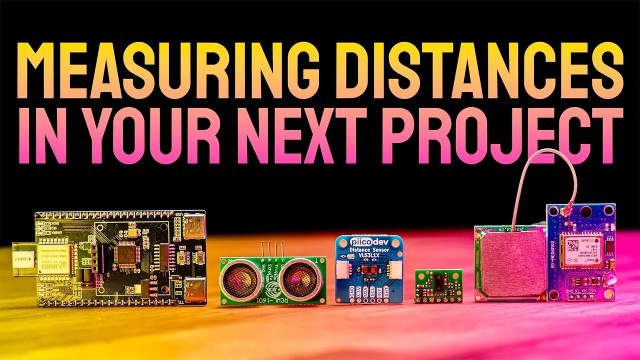
Distance Measurement Methods
TL;DR Key Takeaways :
- Ultrasonic sensors are cost-effective and simple, ideal for basic projects but sensitive to environmental factors, making them less suitable for precision tasks.
- Laser distance sensors offer millimeter-level accuracy for high-precision applications but are expensive and limited in range.
- Multi-zone laser sensors and UWB technology excel in advanced spatial awareness and challenging environments, respectively, but require significant resources or trade-offs in accuracy.
- GPS modules and barometers are effective for outdoor navigation and altitude measurement, though they have limitations in precision and require calibration.
- Camera-based systems and millimeter-wave radar sensors provide high-end accuracy and human detection capabilities but are costly and resource-intensive, suited for advanced applications like autonomous systems.
Laser Distance Sensors: Precision at a Price
Laser distance sensors use infrared lasers to achieve millimeter-level accuracy, making them ideal for tasks that demand high precision, such as object alignment or detailed measurements. Their key features include:
- Exceptional accuracy for precise measurements
- Capability to measure through transparent surfaces
Despite their advantages, laser sensors are more expensive and may face challenges with certain object colors or limited ranges, typically up to 4 meters. These sensors are an excellent choice for projects where accuracy outweighs cost considerations, such as industrial automation or high-precision robotics.
Effective Ways To Measure Distance In Your Maker Projects

Here are additional guides from our expansive article library that you may find useful on sensors.
- Raspbery Pi Whitebox Labs T3 shield lets you easily connect
- Apple Watch 11 Leak Hints at Game-Changing Glucose Sensor
- How to Build a 3D Printer Emission Sensor Box
- Affordable LiDAR sensor designed for makers from $297
- Sensor Watch hackable Casio watch
- Apple Watch 11 Glucose Sensor Details REVEALED
- SmartyPlants plant water sensor help keep your plants healthy
- Garmin LIDAR-Lite optical distance sensor V3
- HC-SR04 ultrasonic sonar distance sensor arrives at Adafruit
- Sweep 360 Degree Scanning LiDAR Sensor Hits Kickstarter From
Multi-Zone Laser Sensors: Advanced Spatial Awareness
Multi-zone laser sensors are designed for projects requiring 3D mapping or enhanced spatial awareness. They provide advanced capabilities, including:
- Grid-based scanning for detailed spatial data
- Support for robotics, automation, and navigation
These sensors are data-intensive and require significant processing power, making them suitable for complex, resource-rich projects. While they offer unparalleled spatial awareness, their high cost and processing demands limit their use to advanced applications such as autonomous vehicles or industrial robotics.
Ultra-Wideband (UWB): Reliable in Challenging Environments
Ultra-wideband (UWB) technology uses radio signals to measure distance, excelling in environments where line-of-sight is not guaranteed. Its benefits include:
- 3D positioning for indoor navigation
- Resilience to obstacles and angles
While UWB is less accurate than laser-based methods, with an accuracy of around 10 cm, it is a strong choice for applications like indoor asset tracking or navigation in cluttered environments. Its reliability in challenging conditions makes it a versatile option for dynamic projects.
GPS Modules: Outdoor Coverage
GPS modules are a go-to solution for large-scale outdoor projects. They provide positional data, including height, and are widely available at an affordable cost. Key advantages include:
- Coverage over large outdoor areas
- Compatibility with various devices
However, GPS accuracy is limited to 1-2 meters and can be affected by obstructions such as buildings or dense foliage. These modules are ideal for outdoor navigation, geolocation, or tracking systems where high precision is not required.
Barometers: Vertical Distance Measurement
Barometers measure vertical distance by detecting changes in air pressure. They are compact and inexpensive, making them a practical choice for altitude measurement. Their features include:
- Accuracy to about 10 cm for vertical measurements
- Suitability for drones and weather systems
Frequent calibration is necessary to account for ambient pressure changes, but their reliability in measuring altitude makes them indispensable for projects involving vertical navigation or environmental monitoring.
Wireless Signal Strength (RSSI): Proximity Estimation
RSSI technology estimates distance based on the strength of wireless signals, such as Wi-Fi or Bluetooth. This method is:
- Simple to implement using existing infrastructure
- Effective for rough proximity estimates
However, RSSI is highly inaccurate and best suited for applications where approximate distances are sufficient, such as proximity-based alerts or basic indoor navigation.
Linear Potentiometers: Reliable for Small-Scale Applications
Linear potentiometers measure distance through resistance changes in a sliding mechanism. They are:
- Reliable for linear motion along rails
- Simple and cost-effective
These sensors are limited to specific setups and are less versatile than other options. They are ideal for small-scale applications like mechanical systems or controlled environments.
Millimeter-Wave Radar Sensors: Human Detection and Security
Millimeter-wave radar sensors use low-power radar to measure distance and detect human presence. They are particularly useful for:
- Security systems and human tracking
- Providing angle and distance data
These sensors must remain stationary and have a limited range of about 8 meters. Their ability to detect human presence makes them valuable for security applications or smart home systems.
Camera-Based Systems: High-End Accuracy
Camera-based systems employ single or dual cameras for distance estimation and 3D mapping. They offer:
- High accuracy up to 10 meters
- Support for object recognition and spatial mapping
While powerful, these systems are expensive and require significant processing power, making them suitable for advanced projects like autonomous vehicles or augmented reality systems.
Motion-Based Measurement: Dynamic Tracking
Motion-based methods calculate distance by tracking movement speed and time using tools like encoders or inertial measurement units (IMUs). They are:
- Flexible for dynamic environments
- Useful for robotics or drone navigation
These methods are prone to drift and cumulative errors, requiring careful calibration and correction. They are best suited for projects involving continuous motion or dynamic tracking.
Tailoring the Tool to the Task
Each distance measurement technology offers unique strengths and limitations, making it essential to align the tool with your project’s specific needs. Factors such as accuracy, range, cost, and environmental conditions should guide your decision. By understanding the capabilities of these tools, you can confidently select the most suitable solution to ensure your maker project achieves its objectives efficiently and effectively.
Media Credit: Core Electronics
Disclosure: Some of our articles include affiliate links. If you buy something through one of these links, Geeky Gadgets may earn an affiliate commission. Learn about our Disclosure Policy.