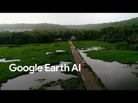
![[ALT 25] Google Earth AI transforming geospatial data into actionable insights](https://www.geeky-gadgets.com/wp-content/uploads/2025/10/img-53-predictive-insights-natural-disasters_optimized.webp)
What if the vast, intricate web of planetary data could be transformed into insights that save lives, protect ecosystems, and shape the cities of tomorrow, all in real time? For decades, analyzing geospatial data has been a labor-intensive process, requiring immense resources and time. But now, with the advent of Google Earth AI, this paradigm is shifting. By harnessing the power of artificial intelligence, Google Earth AI is transforming how we interpret our planet, turning complex datasets into actionable intelligence that drives smarter, faster decisions. From predicting natural disasters to optimizing urban development, this technology is not just about observing the Earth, it’s about empowering us to act on it.
In this exploration of Google Earth AI, you’ll discover how this new platform is automating geospatial analysis, delivering predictive insights, and allowing real-time decision-making across industries. Whether it’s mapping flood-prone areas in hours instead of months or identifying health vulnerabilities with pinpoint accuracy, the possibilities are as vast as the datasets it processes. By the end, you’ll see how this innovation is not just a tool for understanding the world but a fantastic option for building a more sustainable and resilient future. How might this technology change the way we respond to the challenges of our time? Let’s unpack its fantastic potential.
Google Earth AI Innovations
TL;DR Key Takeaways :
- Google Earth AI transforms geospatial analysis by automating complex tasks, allowing faster, more accurate, and scalable insights for industries like disaster management, public health, and urban planning.
- Its predictive analytics capabilities enhance disaster preparedness by combining historical and real-time data to forecast events like floods and hurricanes, allowing proactive responses to minimize risks.
- The platform integrates geospatial data with health statistics to improve public health outcomes, such as tracking disease outbreaks and optimizing resource allocation during pandemics.
- Real-time data processing enables dynamic decision-making, allowing users to monitor environmental changes, such as deforestation or climate impacts, and respond effectively to emerging challenges.
- Google Earth AI supports sustainable and resilient development by providing actionable intelligence for urban planning, environmental conservation, and long-term policy-making.
Transforming Geospatial Analysis with Automation
Traditional geospatial analysis has historically been a time-consuming and resource-intensive process. Google Earth AI addresses these challenges by automating complex tasks, integrating high-resolution data with predictive analytics to deliver insights in real time.
- Processes like mapping flood-prone regions or monitoring urban sprawl, which previously required months of manual effort, can now be completed within hours.
- Automation enhances not only the speed of analysis but also its accuracy and scalability, allowing you to tackle intricate challenges with greater efficiency.
This shift from manual to automated analysis is transforming industries, making it easier to derive actionable insights from geospatial data. By streamlining workflows, Google Earth AI enables organizations to allocate resources more effectively and respond to challenges with agility.
Predictive Analytics for Disaster Preparedness
One of the most impactful applications of Google Earth AI lies in its ability to predict and respond to natural disasters. By combining historical data with real-time updates, the platform offers precise forecasts for events such as floods, hurricanes, and droughts.
- Emergency response teams can use these forecasts to evacuate at-risk populations, allocate critical resources, and plan recovery efforts more effectively.
- For instance, during hurricane season, Google Earth AI identifies vulnerable areas, allowing authorities to implement proactive strategies that save lives and reduce damage.
This predictive capability allows you to act before disasters occur, minimizing risks and improving outcomes. By providing timely and accurate insights, the platform enhances disaster preparedness and resilience on a global scale.
Transforming Planetary Data into Actionable Intelligence
Here is a selection of other guides from our extensive library of content you may find of interest on Google AI.
- Google Android XR Glasses: Features, Benefits, and Challenges
- How to Use Google AI Studio For Free AI Research and Visuals
- How Google AI Studio Makes Software Learning Faster and Easier
- Google AI Glasses: Android XR Features, Applications and Future
- Using Google AI Studio for Smarter Business Growth in 2025
- Use Google’s Gemini AI Studio to Save Time & Boost Efficiency
- How to use Google AI Studio and access to Gemini 1.5 Pro
- AI Basics for Beginners – Google’s AI Essentials Course
- How to Use Google Gemini AI for Free
- Google Stitch: How AI is Redefining App Design for Everyone
Enhancing Public Health with Geospatial Intelligence
Google Earth AI is also transforming public health by integrating geospatial data with health statistics to identify and address vulnerabilities. This approach enables targeted interventions that improve health outcomes and resource allocation.
- Health officials can pinpoint areas at higher risk of disease outbreaks or environmental hazards, making sure that medical resources are deployed where they are needed most.
- During pandemics, the platform can track the spread of diseases and optimize vaccination campaigns, helping to curb infections and protect vulnerable populations.
By offering a data-driven approach to public health, Google Earth AI supports more efficient and effective interventions. This capability is particularly valuable in addressing global health challenges, where timely and accurate information is critical.
Real-Time Data for Dynamic Decision-Making
Real-time data processing is a cornerstone of Google Earth AI’s functionality, making sure that users have access to the most current information. This capability is especially valuable in dynamic scenarios where conditions change rapidly.
- For example, the platform can monitor deforestation in real time, providing actionable insights to combat illegal logging and preserve ecosystems.
- It also enables users to assess the impacts of climate change as they unfold, facilitating timely and informed responses to emerging challenges.
By reducing the lag between data collection and decision-making, Google Earth AI enables you to respond to challenges as they arise. This real-time capability enhances situational awareness and supports more effective planning and execution.
Scalable Solutions for Complex Challenges
Google Earth AI’s ability to handle diverse, high-resolution datasets makes it a versatile tool for addressing multi-dimensional challenges. Whether you are managing urban development, monitoring agricultural productivity, or planning infrastructure projects, the platform delivers tailored insights to meet your needs.
- It integrates data from a wide range of sources, including satellite imagery, weather patterns, and socioeconomic indicators, offering a comprehensive view of complex issues.
- This scalability ensures that the platform can adapt to projects of any size, from local initiatives to global strategies.
By synthesizing diverse datasets, Google Earth AI provides the clarity needed to address intricate problems effectively. Its adaptability makes it an invaluable resource for organizations seeking to navigate the complexities of modern challenges.
Shaping a Sustainable and Resilient Future
The ultimate goal of Google Earth AI is to support the creation of a more sustainable and resilient future. By delivering actionable intelligence, the platform enables proactive decision-making and long-term planning.
- Urban planners can use its insights to design cities that are more sustainable and better equipped to handle the impacts of climate change.
- Policymakers can use its data to balance economic growth with environmental conservation, fostering a more equitable and sustainable future for all.
This forward-looking approach enables you to address today’s challenges while preparing for tomorrow’s uncertainties. By integrating advanced analytics with real-time data, Google Earth AI provides the tools needed to build a future that is both resilient and sustainable.
Media Credit: Google Research
Disclosure: Some of our articles include affiliate links. If you buy something through one of these links, Geeky Gadgets may earn an affiliate commission. Learn about our Disclosure Policy.